

Satellite remote sensing is a vital technology for rapid and large-scale atmospheric pollution monitoring, offering advantages such as high efficiency, objectivity, and cost-effectiveness. It also plays an indispensable role in accurately identifying pollution sources and constitutes a core component of modern environmental monitoring systems. Developed by the State Key Laboratory of Remote Sensing Science at the Aerospace Information Research Institute (AIR), Chinese Academy of Sciences (CAS), the Atmospheric Pollution Precise Localization and Source Tracing Platform (hereafter "Tracing Platform") builds on over two decades of expertise in atmospheric environment remote sensing. By integrating satellite remote sensing, atmospheric modeling, and big data on pollution sources, this independently developed platform enables efficient large-scale monitoring and dynamic source tracing of atmospheric pollution at national, provincial, and municipal levels. It applies to both scientific research and practical applications in atmospheric environment monitoring and pollution control, directly supporting sustained air quality improvement.
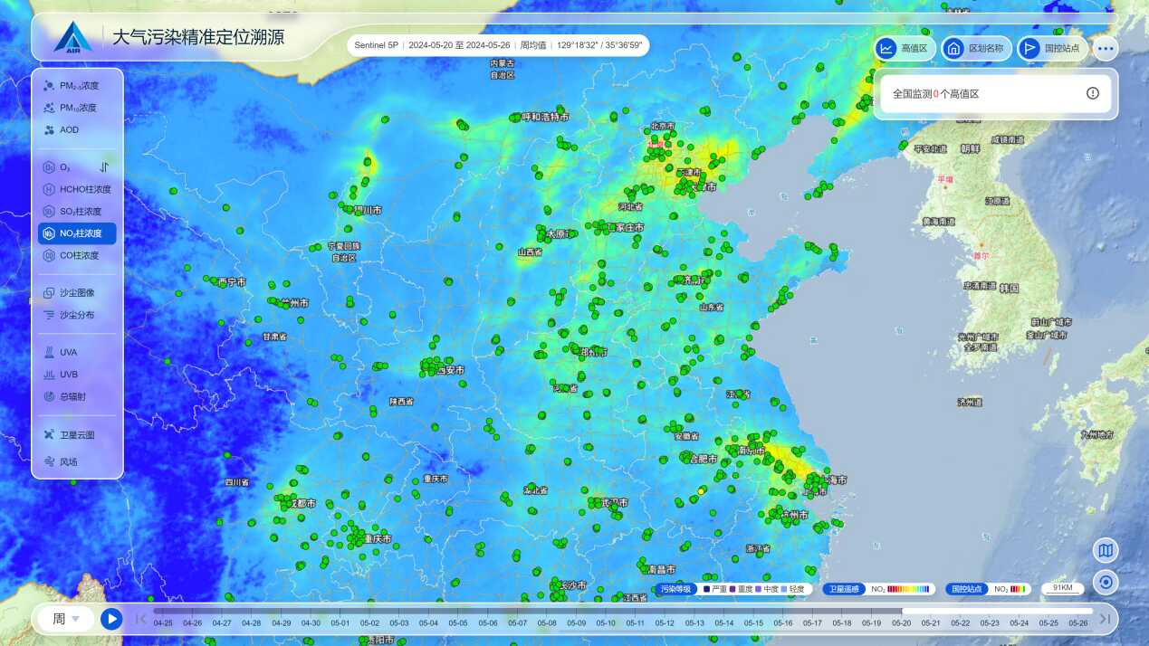
Figure 1: Platform interface
Core Features:
The Tracing Platform is designed to address challenges in the rapid and accurate identification of pollution sources, a critical need for sustained air quality improvement in China’s new era. Its key capabilities include:
1. Monitoring nationwide concentrations of key atmospheric parameters such as Aerosol Optical Depth (AOD), fine and coarse particulate matter (PM₂.₅ and PM₁₀), sulfur dioxide (SO₂), nitrogen dioxide (NO₂), ozone (O₃), carbon monoxide (CO), and formaldehyde (HCHO).
2. Tracking key factors influencing O3 formation, including temperature, solar radiation, and emissions of natural biogenic volatile organic compounds (BVOCs).
3. Dynamically identifying PM2.5 and O3 pollution hotspots nationwide, locating enterprises with a high probability of being emission sources, enhancing the efficiency of pollution source identification, and enabling remote, non-contact source attribution.
4. Providing real-time, nationwide monitoring of crop residue burning, including fire detection, estimation of burned area, and assessment of associated impact on air quality.
5. Tracking the real-time spatial distribution of dust storms.
6. Precisely monitoring dust emission sources.
7. Objectively evaluating changes in pollutant concentrations before and after the implementation of pollution control measures in target areas.
Product Lead
Contact: Prof. Tao Jinhua
Email: taojh@aircas.ac.cn
Tel: +86 10 6488 9545


